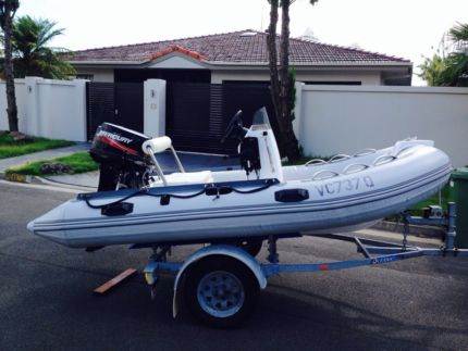
Hey guys, I bought a 14 foot RIB (alloy centerconsole) with a 4 stroke 30hp merc on the back. I have had a fair bit of boating experience (old boy owns a 18 foot boat).
So, I have epirb/flares/PDFs/radio/oars.
How much fuel will i need, I understand you can fill up on the island? The tank is 20L and I have 2 20L spares though would ideally only take one.
The battery is new and have had no issues. Is it worth still having a spare or jumper leads? Also i think you can pull start it if the battery ever did fail.
No sounder or GPS, is this a big deal??
I live in Mullaloo so will launch of hillaries, is worth starting from freo for first time. Also would you run the coastline until scarbs or cities (even further) before heading out deep? Or just go in a straight line from hillaries to rotto.
I realize I will have to pick my days carefully and will book accomadation to stay the night.
Any other advice will be great! Cheers
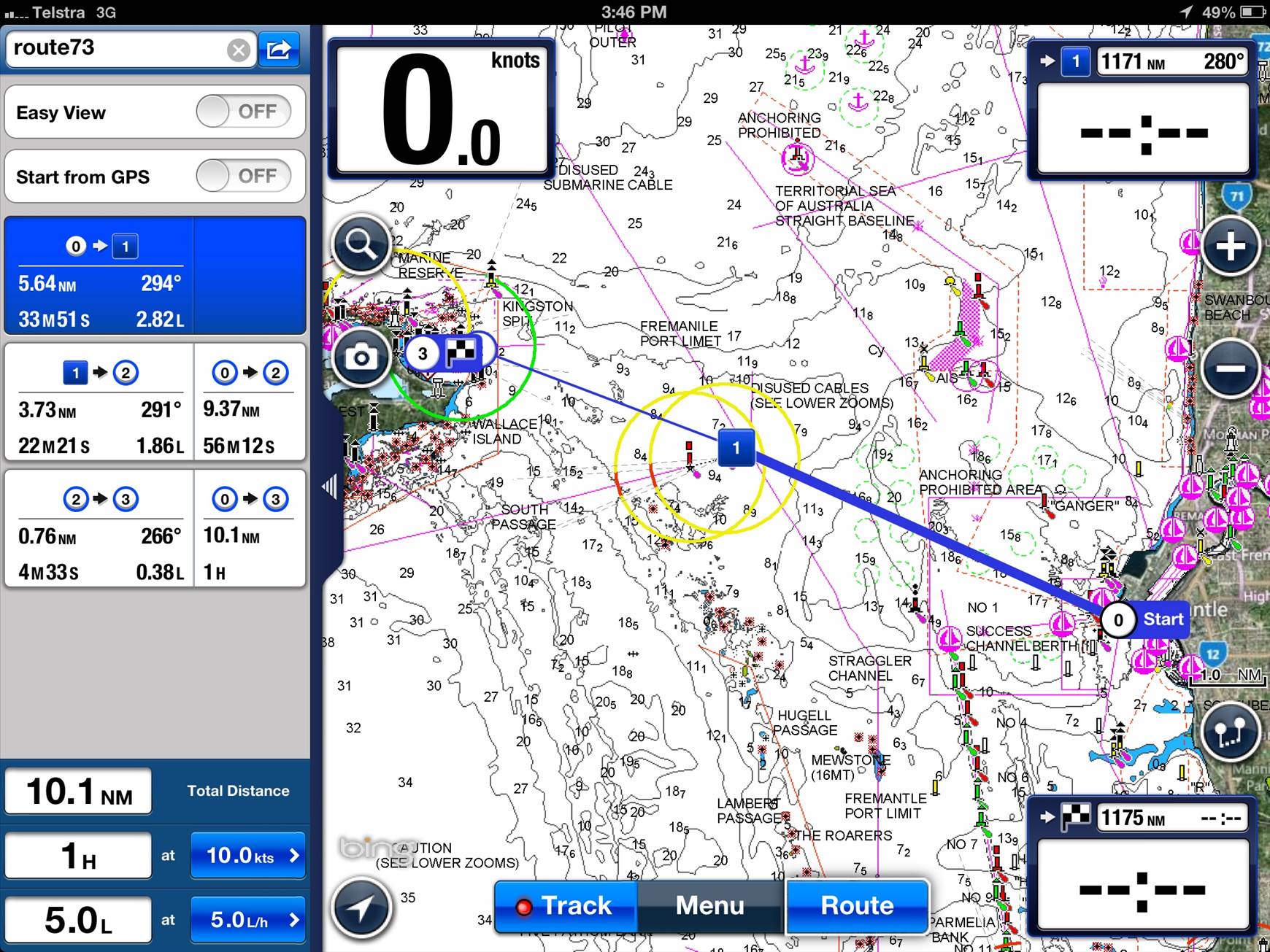
Gotta have a fully mapped gps mate, download Navionics to your iPad and have a look at the charts.
With fuel, you'll need to work out your consumption - no point guessing. Use the above app to figure out how far you are travelling and then work out how much fuel you will need.
Do the run with someone who is experienced first mate then you will know what you're in for. Always log on and off.
This link might help if you have not already looked at it
:- http://www.rottnestisland.com/boating-information
and
There is also this
www.whitfordssearescue.org.au/forms/rotto_convoy.pdf
and also this link:-
biawa.asn.au/pages/rottnest-safety-convoy-2
all worth a look I recon..
To me 30 horses is really small but then I like to be safe![]()
Having lived at Rotto that darn sea is SO unpredictable.
Good Luck![]() Jono
Jono
Cheers for the links mate. 60 bucks for a 'tour' to rotto and the bays is super cheap! As for fuel I will get there in 20L, though its hard to tell how much I will use there. But I can see fuel is available there 24/7. Cheers for the advice, Ill have a better look at Navionics, have been using it today (5km out off lanos) but just used it to reference location, not a guide to get out/in.
Yeah mate, they have updated it with most of the markers into the bays so you can plot a course from there. Careful on the fuel though, wind or a bit of chop can double your fuel consumption pretty quick.
Select to expand quotedinsdale said...
If you have to ask that here, don't do it!
This guy is on the money and he got a red thumb ! ? ![]()
If leaving from Hillary's easiest route is straight through the gap in the reef (approx heading 248deg from entrance), you will see it on navionics and other boats using it. The gap is not suitable in large swell but then neither is your boat. Other alternative is stay inside reef to southern cardinal marker and then head out. After that pick a bay/ heading. Watch bom marine maps, I think better than seabreeze for forecast. Head home in morning on an easterly as the afternoon seabreeze swell gets quite big. I'm currently anchored in parakeet bay, it's stunning :)
always take more fuel than you need to get there and back.
know your cardinal markers
study the charts
Dont rely only on gps
Check in with port authority before and after the trip
Radio check
Coming home in the seabreeze in a boat that small will be rough especially in a RHIB
Tell someone when you leave and when you get home.
Rottnest To Hillarys Distance
Distance between Rottnest and Hillarys is 31 KM (kilometers) and 477.37 meters. Rottnest is 19.6 miles away from Hillarys
Rottnest To Hillarys Travel Time
Travel time from Rottnest To Hillarys will take 0 hours and 47.22 minutes if the vehicle keep an average speed of sixty kilometer per hour
Dinsdale is spot on!!
Still, your in a rib , should float well upturned, make sure your EPIRB is in good working order
32 knots is humming along, I recon you could average 20ish on a good day (light offshore)
The return journey , well 20knt swester , 1.5 - 2mtr swell , good luck!
Basic stuff, but you'd be surprised - Some flares, epirb, DECENT pfd's (not those cheap sh!tty yellow block ones), make sure you log in/out with Freo Sea Rescue.
What could go wrong? ![]()
Best of all, take someone who is expeinced for your first trip.
Have a good one!
Poods
couple of tips...invest in a pair of polarized sunglasses if you don't have some already. This will help you see the reef easier and cut out glare. Also don't rely completely on your GPS charts, my first trip across was on a super low tide and i clipped a finger of reef that was not marked on my gps chart. I snapped a couple of inches off my skeg....luckily no damage to the hull but scared the ** out of me.
Rotto is definately a boaties paradise, you don't realise how good it is when your land locked on the island. So many options for watersports too! ![]()
Mate don't listen to people who give negative comments. I have some negative comments too but I'll be positive to try to help you. Firstly I don't have a gps and so long as you have a real good read of a map first it is easy. I go from freo straight there. In slightly heavier seas I aim towards the north end of the island and turn twoards the island when I am nearly there or go around from the north. If u do the north thing watch out for the reefs at the front near transits. I go north because about two thirds of the way to the island the swells can mutate a little bit because some swell come straight from the south west and some wraps around the island and comes from north west. Don't go skint on fuel. Take two tanks at least. It's good you've checked your battery. Choose a day when all predictions are for basically no wind, not chance of a wind. On a good day a ski boat can gett there. My dad did that once, probably not smart. On a bad day you'll wish u didn't go. Private message me if you want mate I'm no expert
Buy a paper chart. They are not that expensive and will show more then a GPS chart at first glance. Plan your trip over on the paper then transpose that onto your navionics for the trip. Either that or plot your course on navionics and zoom right in and double check. A lot of structure doesn't show until you've zoomed ALL the way in.
Fuel is a hard one. I have been to Rotto with four POB and burnt nearly 200lts in fuel return (from Como), but went and burnt 70lts of fuel with 7 POB return from same place. The difference in the weather though were at extremes. The first one I likely underestimated they weight of everyones dive gear and eskies.
I don't believe you must have a GPS chart as stated above, but a GPS would be beneficial. You should at a minimum though have a paper chart and know how to read it.
Lastly, I have said it here before........ Just because you could go, doesn't mean you should go.
ally rib would be a rough as **** ride .
at 14 foot you would have a very small window of days you could go over
Yeah I don't want to sound negative but the guy above is bang on. I've seen it done but fourteen foot is very very small. You can do it but window of opportunity is so small.
This is 17 feet, who would take the chance?
Stay safe , plenty to do in a small rib close to shore or get a bigger boat if you have the desire to go to Rotto.
4 yrs ago we went to rotto, booked a mooring , quick calm trip over , forecast, light offshore, cooked a bbq for tea, had a few beers good nights sleep, Until 4 in the morning . The forecast was way out ![]() , the wind (easterly) was a howling 30knts +, we waited until 10am and it didn't drop , it got worse, so we decided to head back to Rockingham, in a 6mtr ali , we hit a top speed of 10knts, misses had lifejacket on for the first time ever, one hell of a return .
, the wind (easterly) was a howling 30knts +, we waited until 10am and it didn't drop , it got worse, so we decided to head back to Rockingham, in a 6mtr ali , we hit a top speed of 10knts, misses had lifejacket on for the first time ever, one hell of a return .
Don't take risks on the water you will only do it once!!
My experience with paper charts are they are great for plotting a true coarse and converting to magnetic for use on compass. but should be done before departure on the kitchen table as trying to use paper charts in 30 knots and 3 m seas with rain can be very difficult.
Best is to have a handheld GPS with a serious of way points programmed for your passage which you have entered from your chart way before you even get to the boat ramp. The GPS will show cross track error (how much your off coarse) and distance to your arrival. Also it will show your lat and long if **** hits the fan something navionics does not have a good function for.
Navionics shows your lat long by tapping your position and hit the ? That comes up, position is at top. Personally I'm a big fan, my boat has a fantastic plotter but navionics is easier to zoom and pan around. I know a couple that bought a yacht in the USA and sailed back to Hillary's marina with only 2 iPads for navigation, no paper charts! Personally I'd take a ipad over paper, when it's all going on and you're close to reef it's reassuring to look at the screen and see exactly where you're at rather than look at the chart, take some compass bearings and work it out. Ipad is also more accurate than gps if you have a phone signal as it uses the towers as well as the satellites.
Don't get me wrong, I use a GPS chart plotter and navionics for actual navigation. However for a trip planned for the first time, I always plan on paper charts and then add the route on navionics. Once it's saved as a route then I don't go back to the charts.
The reason I do this is because I plotted a course once on the GPS charts and almost hit a bommie. I saw it in the trough of a wave as I passed it at speed by about 2 metres. When I had a look latter on the paper chart there it was, as clear as day. It was also on the GPS chart, but I had to zoom a long way in (more then I had when plotting the course) for it to be shown on the map. I'm not suggesting paper charts are infallible, but they do show more detail at initial glance.
I think a onbord GPS maybe the go. Navtronics is great but to hold my iphone the whole ride while getting wet may not be the smartest idea.
Kent we are on, you can drive back after the pub!! (kent lived in rotto so has done it many times, should of asked him first!!)
Cheers for all the advice, dont stress i will not be taking the boat over in stupid conditions. I surf/dive/kite so will be in a wettie and looking for swell less than a meter and light winds.
As with paper charts, my old boy is sending me his as I type, but laughed at my ability to read them.
Cheers for all the pointers they have been researched and I now have a reasonable idea on what to expect and not to take my chances on iffy days.
The misses agreed if I use this boat enough I will get a real boat in 2015!
Fat old peeps with no hair do stand up paddle board races there don't they?
Wait for a calm day, forget all the negativity. Read the responses, and take what you need on board, don't get obsessed with tragedy and impending disaster. Buy yourself a couple of silver Sapporo cans and open em on arrival - you made it.
Jessie Martin sailed around the world - he was only 17 when he did that. I didn't see him posting here for noob advice. Remember, you are dead a long time. Do it!
Select to expand quoteadolf said..
Fat old peeps with no hair do stand up paddle board races there don't they?
Wait for a calm day, forget all the negativity. Read the responses, and take what you need on board, don't get obsessed with tragedy and impending disaster. Buy yourself a couple of silver Sapporo cans and open em on arrival - you made it.
Jessie Martin sailed around the world - he was only 17 when he did that. I didn't see him posting here for noob advice. Remember, you are dead a long time. Do it!
I am not fat, I have got lots of hair but I am old.
ET.![]()
Firstly you need 2 batteries if its the only way to start your engine or you dont have an auxiliary motor and they need to be marine batteries
I have had the situation where ive gone over a wave hit hard and the battery plates have fallen off! fortunately had the aux to get home on .
Secondly I would not take a 14' tender over open ocean out to rotto unless it was life and death and had 2 spare fuel tanks
Maybe you can do it do you really need to put every one elses lives at risk if you frack it up
Jono if it blows up just tuck in behind a ferry for the trip home. We had to do that in a ski boat a few years back when the sou'wester hit 25+knots. ![]()
Select to expand quoteadolf said..
Fat old peeps with no hair do stand up paddle board races there don't they?
Wait for a calm day, forget all the negativity. Read the responses, and take what you need on board, don't get obsessed with tragedy and impending disaster. Buy yourself a couple of silver Sapporo cans and open em on arrival - you made it.
Jessie Martin sailed around the world - he was only 17 when he did that. I didn't see him posting here for noob advice. Remember, you are dead a long time. Do it!
adolf the crossing to rotto can turn very ugly quickly and alot of people need help from the fremantle sea rescue due to going out in conditions that are outside their or the boats capacity .
I used to have a 6m fiberglass rib and in anything over 15 knots it became uncomfortable and wet . a 14 foot ally rib , fark me that will be a rough as guts ride . Be careful with your rib in rough seas it will bang side to side quite a bit . But the beauty of a rib is it will only tip to one side so much before the pontoon stops it . Can also be a handfull running directly with the swell if the nose digs in be prepared for a wall of water to come back over the boat, making everything wet .
If it is rough then yes pick a ferry or something as big to follow but you need to be sure that your boat can go fast enough to keep up with the ferry :)
with the size of your boat i would suggest you log on with fremantle sea rescue or even better become a member for something like $40 . Because if the **** hits the fan they are the ones coming to help you .
honestly in a 14 footer i would not go from hillarys , i would launch at the east freo boat ramp and head straight out from the heads . Need any more info pm me.
14ft that's a bit keen, it can turn from a really nice day on the water to hell in a matter of minutes once the seabreaze comes in. I have been over in an 18ft boat and that was small enough. I now have a 21fter and that's just enough. But good luck with it