Look at sat and Sun 17 and 18 Dec.
I can think of no.reason why that won't be a regular green arrow seabreeze.
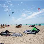
As the forecast is the average of all wind graphs, is this because of the new fremantle harbour ones? Wouldn't Seabreeze WA be better using an ocean reef, Scarborough (non-existent), swanbourne average and leave out rotto and river? ![]()
Synoptics show trough still hanging around and a low in the bight. Doesn't look like a chart for a strong SB to me.
I thought there might be a better swell forecast given the front passing across the SW tip that weekend.
I would prefer to keep the river in there since I live right next to Melville and there are always heaps of people on the river. Also lot's of schools teach on the river and they obivously use the graphs as well. what about:
Woodmans point
Safety bay
Leighton
Melville waters
Point Walter
Scarborough
Swanbourne
City beach
and yet I spent 2 hours trying to tack out to a certain spot and never made it due to light winds then on the way home called in to my regular and it was 25kn![]()