Weather | Buy&Sell | Forums |  |
Weather | Buy & Sell | Gallery | Forums | |
Hi there.
Anyone been to Kyeemagh today?
How was the wind? I checked the graphs and it was just a little confusing. Kurnell had 12 to 15 kts and airport had 5kts. I decided to not take the long drive down from the mountains but wondered whether I just have taken the Kurnell graph as a guide or the airport one?!!
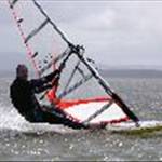
The wind started around 2pm, light and It was around 12-18 knots. I was on a 7.8m so planing about 80% of the time.
Cheers. Didn't miss to much then. Where would be a good spot on the harbour?The graph there looked pretty solid.
Raz,
I'm a bit suspicious of that Syd harbour graph and I reckon it over-reads a few knots in NE. I've been at Balmoral and was checking the live readings last summer & it's not as windy as the readings say. Balmoral usually is better for NE than Manly for example as the NE has a slight funneling effect there.
I think the harbour graph is on one of the towers off Bradley's Head and when the wind is NNE (often later in the arvo) then it could be accurate.
Good spots to launch would be Rose Bay or Bradley's Head (although parking is metered & busy on w'ends).
I have sailed from Balmoral to Camp Cove in a good NE and Balmoral is a good f/w spot but the parking on w'ends makes it a pain.
To find out exactly what everyone did yesterday on Botany, have a look
at the GPS Team Challenge page. ![]()
Lots of reports there.
gpsteamchallenge.com.au/sailor_session/show?date=2011-09-04&team=5
Kyeemagh was perfect, flat water and 15-18knots. Car parking and avoiding BBQ's at the south end was the biggest issue!
I always thought that Kyeemagh was windier in a NE because the wind accelerates across the airport runways?
When you sail across from kurnel to the runway there is always a noticible drop when you get in the shadow of the port itself (channel thru center of the bay) then it picks up again once you get in behind the runway.
The green area is wher the wind is usualty stronger and the red is where the wind tends to have bigger holes in it.

You don't think maybe it just 'feels' stronger behind the runway cause the water is flatter? I'm not at all saying I disagree, I'm just hypothesising....

Just when you thought you knew everything, something gets posted on a Seabreeze forum!.......How cool is wind?....Wind rocks & Botany Bay rocks big time!![]()
The roughness of the water will also be having an effect. There's a thing called "roughness length" which I gather is pretty hard to determine, but it goes in the logarithmic profile equation (I also gather it's more of an approximation than an equation). The rougher the surface the more the logarithmic profile is stretched vertically. Inland waters with less fetch and chop allow the wind aloft to get down closer to the surface. Once you're clear of other obstacles of course.
I just rig a sail size bigger than the forecast suggests, that usualy solves the problem and makes it exciting in the gusts. ![]()
Ian K,
love the science stuff.
As long as the harbour gets windy in a NE/NNE, we just have to get out there!
I was there on Sunday at Dolls Point. It's my 3rd time there and I find the graph has been fairly accurate. Though I reckon on Sunday and the other couple of days it was a few knts stronger (at times) than the graph stated.
I'll be taking a wind meter next time to check my hunch.