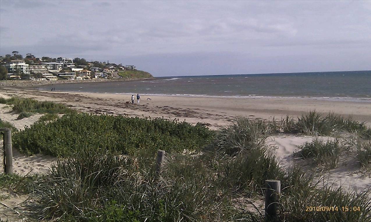
muirs said...
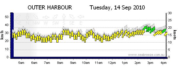
Its a sw gradient tho, there is also a change in direction of the Gradient which would have rolled over around mid afternoon. A front is techniqually a change in wind direction I think, so Id say it's just frontal. just not a big enough front to warrent the spikey line thing. Plus it was only about 15 deg. I like your optimism tho!
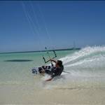
Sea breezes can develop with the right temp gradient between land and sea. Even though the air temp is quite cool at the moment, the water is still cold from winter, and as long as the isobars are generating a southerly wind component, a small temp rise over the land should develop a seabreeze (lucky for us at the moment).
Sea Breezes on the NSW Coast
By Kenn Batt
Nature and Causes
Sea (and land) breezes are caused by unequal heating and cooling of adjacent land and sea surfaces. A sea breeze is one that blows from the sea to the land in consequence of this differential heating.
During the day, especially in spring and summer, solar radiation causes the land surface to become warmer than the sea surface. From about August through to December, off the NSW coast, cooler sea water temperatures prevail, while the warming effect of solar radiation is increasing to its maximum. Therefore the contrast between land and sea surface temperatures becomes considerable during, the day, being greatest around mid-afternoon.
Without going into the mechanics of the matter, suffice it to say that the warmed air rises over the land surface and a local circulation commences, with cool air from the sea being drawn in over the land. At the same time the ascending air returns seaward in what is known as the upper return current (See the diagram below).
Just as a fire in a grate causes an up-current in a chimney, the updraught becoming progressively stronger as the fire burns more vigorously (and vice-versa), so the sea breeze gains in momentum and spreads over a greater area of land. A normal sea breeze in late spring or early summer may extend 80 to 160 km inland during the afternoon (complex orography can complicate this somewhat). Under very favourable circumstances the sea breeze may penetrate as much as 200 to 300 km inland by about midnight, and on rare occasions to 400 km. The sea breeze is detected by its maritime characteristics, such as lower temperature, higher humidity, and as well as by actual tracking of the wind change.
Canberra not infrequently experiences a sea breeze in summer evenings (Canberra is approx. 120 km inland and at an elevation of around 600 m). The further inland, the weaker and less identifiable the sea breeze becomes, and the shorter its duration.
Sea Breeze Development
With weak general wind circulations (around the centre of a high for example), a sea breeze (pure sea breeze) will commence over the coastline soon after the land temperature begins to exceed the sea temperature (late morning to early afternoon). As the difference increases, so the sea breeze will become stronger and will extend farther inland. It will also increase in depth from about 100m to as much as 450 to 800 m in a well developed breeze. Maximum wind speed (14 to 16 kt) will occur during the few hours after maximum temperature has been reached. This would generally be during the mid to late afternoon.
A weak sea breeze will die away soon after sunset, but a better developed sea breeze will persist at the coast till 8 to 10 pm., usually dying away fairly suddenly at the coast and slowly moving seawards as a cut-off sea breeze circulation.
With stronger general wind circulations, coupled with the required temperature gradient, the development of the sea breeze can be complicated to say the least. Obviously a moderate to strong , prevailing off-shore surface wind will delay the onset of the sea breeze and if strong enough, say over 20 kt, will prevent the sea breeze from developing at all. On-shore surface winds are generally enhanced by the sea breeze component. On the other hand, if we have a light to moderate prevailing off-shore 900m (900m above the earth's surface, commonly known as the Gradient level) wind, with say a direction from the northwest through to the north, then we can generally expect a re-enforced sea breeze at the surface-Sydney's super sea breeze. In this situation, our strongest sea breezes will occur on the south coast of NSW, with speeds well in excess of 30 kt.
This super sea breeze around the Sydney area will have wind speeds in the range from 20 to 25 sometimes 30 kt. It will stay in longer at the coast, say until around midnight, sometimes 1 am, before becoming cut-off and moving away from the coast.
The rule is that 900m wind directions from offshore tend to favour sea breeze development, whilst those onshore tend to either complicate the sea breeze or make sure that we don't get a sea breeze at all.
Wind speeds either at the surface or at 900m in excess of 20 kt will generally keep a sea breeze out, providing that speeds don't drop out over the late morning or early afternoon period.
Sea breeze Direction
It is found that a sea breeze will generally start up as a light onshore surface wind, at roughly right angles to the coast, before moving in a counter-clockwise (southern hemisphere) direction as the breeze increases in strength.
A pure sea breeze will by mid-afternoon, over the Sydney area for example, have a direction from the northeast, whilst a re-enforced sea breeze would have a direction more from the north-north east.
The start-up and final sea breeze direction (and speed) will depend on the orientation of the coastline as well as the complexity of the coastline (steepness, headlands, bays, estuaries, etc).
Cloudiness
On cloudy days convection currents over the land (due to solar heating) are prevented or restricted. Thus the sea breeze circulation does not develop to any appreciable extent, and on many occasions of cloud cover will be non-existent.
On the other hand a well established sea breeze may contribute to cloud formation, of two kinds in particular:
large cumulus and cumulonimbus (thunderstorm clouds) which require an inflow of moist air in the lower levels. In fact, the sea breeze can provide the moisture to help form thunderstorm clouds. Once these form on the ranges to the west of Sydney, these clouds are generally steered toward the coast. Once these clouds get close to the coast, the sea breeze decreases in strength, whilst its direction will veer towards the east. Very soon after this, the sea breeze falters, we enter a short calm period before being hit by wind squalls out of the storm clouds. So the moral of the story is that the sea breeze can lead to its own demise.
low stratus (scud), in the late afternoon as the moist sea breeze air becomes cooled and is also lifted slightly over the land. Alternatively the inflow of moist air in the lower levels may result in widespread fog over the coastal plain later in the night.
Conclusion
It would certainly pay the keen yachts person to spend a great deal of time studying the sea breeze as it can be quite complex on any one day . This article hopefully whets the appetite and a further article will home in on the complexities of the sea breeze.