Weather | Buy&Sell | Forums |  |
Weather | Buy & Sell | Gallery | Forums | |
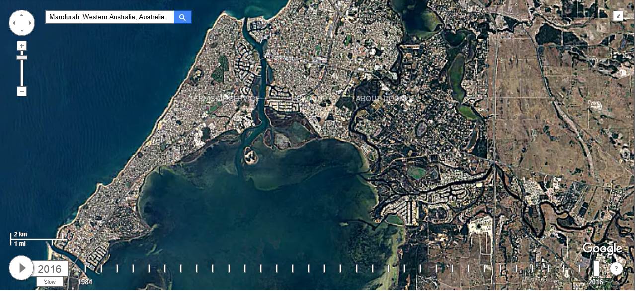
Fun tool to see how your favourite speed strip has changed over time ![]()
And to see how increasing urbanization is rooting the planet ![]()
earthengine.google.com/timelapse/

interesting.
It looks like "the Pond" is indeed destined to become a pond.
The council are wasting their time with that dredge.
I think our speed strip will soon be sanded up
somebody mentioned to me the other day, that one of the councilors lives just behind the ramp and has a boat. The feeling was that it's his stupidity that are costing the rate payers a lot of money fighting this loosing battle.
The following are time lapsed satellite photos of Sandy Point from 1984 to 2016 showing the progressing of the vegetation eastward along the dunes


Those Sandy Point point images look unchanged compared to what has happened over this side of the country over the last 30 years.
And while I wont be here to see it, this is what the future may be after 1m and 7m sea level rise


Hardie should be fine..Fangy not so much :-))
Just took my boat off the market ![]()
(the council is taking this seriously - the new 'sea wall' along from S bend is a case in point)
^ I can't possibly believe that the council was ever swayed by the developers of all those multi million dollar canal sites. ![]() And to be fair to MCC, it's possible that sea level rise was not on anyone's radar back in the early 90's. (Apologies to JJ for taking your thread off topic)
And to be fair to MCC, it's possible that sea level rise was not on anyone's radar back in the early 90's. (Apologies to JJ for taking your thread off topic)
The council didnt really have a policy on all this before it happened because no one wanted to develop it prior to happening. Its not like they were knocking it back and then changed their minds. Anyway the yunderup canals were done in the seventies and people have been in low lying areas like coodanup and riverside gardens for yonks. When i was a kid forty years ago there was no exposed sand bar or island in safety bay, thats all new.