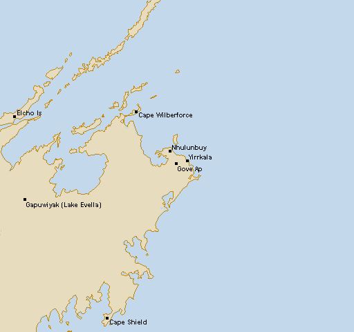
About Gove Radar
The Gove radar has a nearly unrestricted view in all directions. Local topography can produce a single weak false echo immediately adjacent the radar centre to the southeast. During the wet season, thunderstorm tops will be visible out to the effective range of the radar at around 250km although smaller showers frequently associated with these storms will not be visible at that range. Tropical cyclones may be seen during the wet season months November to April, although lesser category 1 cyclones may not be sufficiently developed to be easily discernable. The higher category tropical cyclones will display rain echoes in spiral bands rotating about a central clear eye with the highest intensity rainfall about the eye. The structure of the cyclone in the arc facing the radar centre will be seen, although the far side will be less clear due to the weakening of the radar signal by heavy rain (attenuation). The closer the cyclone is to the radar centre the clearer the structure will be viewed. Rain showers during the dry season are common; most frequently moving from east to west, often in organized lines (known as Gulf Lines) orientated approximately north-south. Cooling after midnight during the dry season frequently results in false echoes (Anomalous Propagation) appearing over the land as isolated weak areas with sometimes up to 80% coverage. These echoes are identified by their random appearance and disappearance between sequences with no general direction of movement and total dissipation after sunrise. They only appear over land and are displayed as the weakest level echoes.